Oil and Gas Prospectivity of Onshore Timor-Leste determined by the unique IGTI technique by modelling on multiple integrated parameters – The publication of GeoProspect’s Timor-Leste Onshore Prospectivity Report

GeoProspect™ is pleased to announce that their Timor-Leste Onshore Prospectivity Report will soon be available for licensing.
While the offshore area of Timor-Leste is well populated with both modern 2D and 3D seismic data, and many wells, the onshore blocks demonstrate a common sparsity of seismic data and only a few old wells, and some gravity and magnetic data.
The prospectivity of oil and gas reserves within onshore Timor-Leste were identified using a powerful method of integrated geological and geophysical modelling and pattern recognition called IGTI. The method used the known locations of the oil and gas reserves as seeds to equate them to desired targets in the wider geospatial matrix of onshore East Timor. Various geological and geophysical signature patterns were then used as inputs to characterise the seeds. A broad category of the key input parameters were geodynamic boundary conditions, rock properties and structural settings.
A total of 14 reliable and stable input parameters were used to derive their integrated signals. Pattern recognition method was then used to identify similar patterns in the wider area of onshore Timor-Leste. The findings of the report suggest that the onshore region of Timor-Leste is rich in both oil and gas reserves, with the depth of the reserves vary between shallow depths of 1.5 km to depths exceeding 5 km.
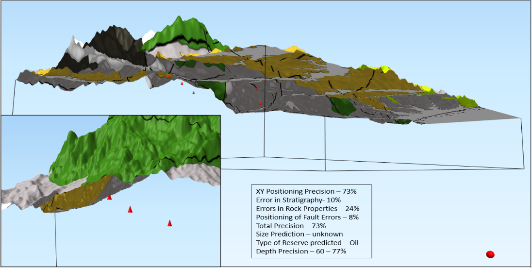
Derived locations of the Potential Oil Reserves in red cones. The red sphere is the focus of one of the earthquake events used as a position index.
IGTI is a method that uses pattern analysis, extraction and identification of seeds grown within the target area with a known production history. The recognised patterns are further used to identify exploration targets within the blocks where, initial exploration data is sparse to absent. The method uses proprietary equations for salting the exploration blocks.
GeoProspect™ is a joint venture between Zebra Data Sciences and Cambridge GeoConsultants, which has already resulted in one successful Prospectivity Report of Onshore Croatia DI16.
For more information, please contact info@zebradata.com